A southern Guam drive combines coastline, tropical vegetation, CHamoru villages and sites connected to the Spanish era and World War II—all beyond Tumon’s resort district.
A practical plan is a full-day loop from Tumon down the east coast through Inalåhan and Malesso’, around Humåtak, then back on the west coast. Keep the schedule flexible enough to return to the hotel area before dark.

Suggested southern loop
- Morning: leave Tumon after checking fuel, weather and navigation
- Morning stop: Talofofo Falls Resort Park
- Late morning or afternoon: Inalåhan Pools
- Afternoon: continue through Malesso’ to Fort Soledad in Humåtak
- Return: add Ga’an Point in Hågat only if time allows
- Before evening: return to Tumon along the west coast
You can omit Talofofo Falls and focus on the coast and historic sites. Reduce the number of stops when opening status, squalls or sunset timing require it.
Before leaving Tumon
- Check the fuel gauge and refuel in Tumon or Tamuning if necessary
- Carry water, sun protection, rain gear and shoes with reliable grip
- Download the map and set destinations while parked
- Check opening, admission, road restrictions and Guam EPA water-quality information
- Leave no bag or valuable visible inside the vehicle
1. Talofofo Falls Resort Park
Talofofo Falls Resort Park is a privately operated paid attraction, not a public park. It is known for broad waterfalls and a cable car; Guam Visitors Bureau also lists a history museum and other on-site attractions.
Days, admission and operation of the cable car or individual facilities can change, so confirm directly before travel. Much of the attraction is outdoors, and steps or paths may become slippery after rain; it should not be presented as a guaranteed rainy-day activity.

2. Inalåhan Pools
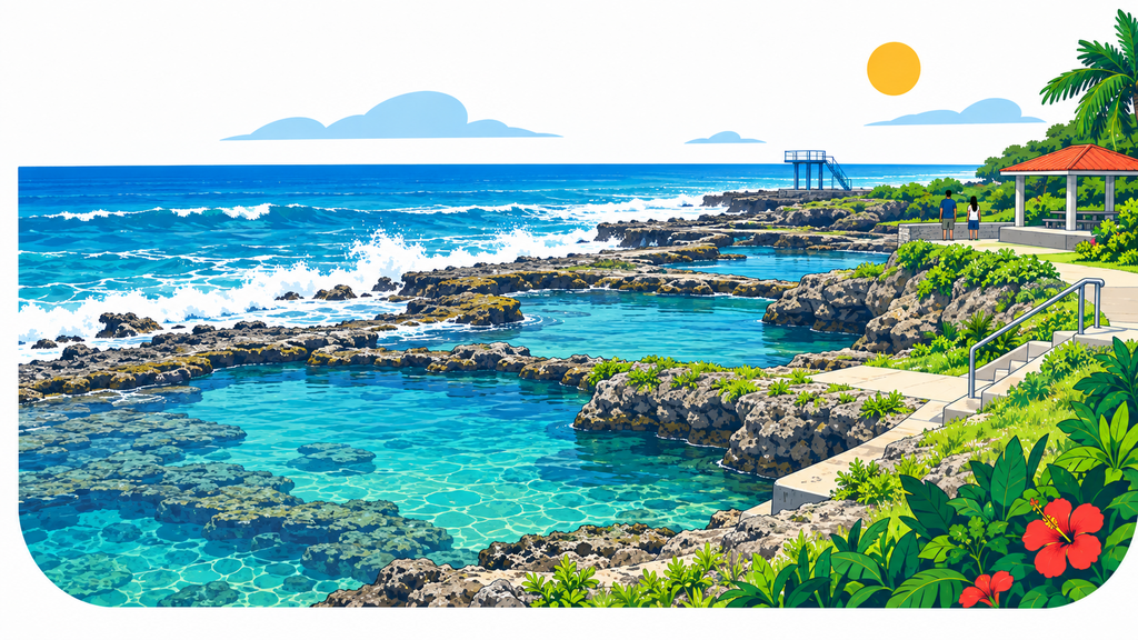
Inalåhan Pools is described by Guam Visitors Bureau as natural saltwater swimming holes protected by the reef. Its several pools and the surf beyond the barrier create one of the southeast coast’s distinctive views.
“Natural pool” does not mean safe in every condition. Tide, outside surf, rain, footing and water quality change. Guam EPA includes Inalåhan Pools in its regular monitoring locations, so check the latest advisory and on-site notices. Never jump from a platform or high rock; enjoy the view only when conditions are uncertain.
3. From Malesso’ to Humåtak
South of Inalåhan, the route passes through Malesso’ before turning onto Guam’s southwest coast. Slow down near homes, churches and schools, and watch for pedestrians. An ocean view is never permission to stop on a narrow shoulder or enter private property.
4. Fort Soledad: Spanish history above Humåtak Bay
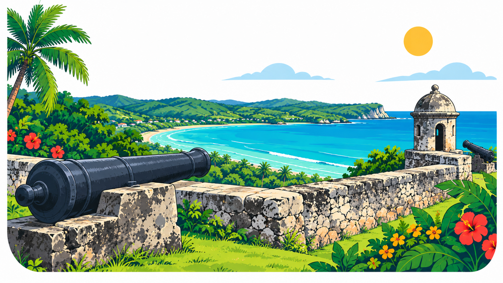
Fort Nuestra Señora de la Soledad overlooks Humåtak Bay. According to Guam Visitors Bureau, Spain built it between 1802 and 1819 as the last of four forts constructed to defend the bay. The preserved public site includes a restored sentry box and cannons with broad bay views.
Do not climb on the walls or guns, and stay back from exposed edges and wet surfaces. If storm clouds build, prioritize a safe departure over the view.
Optional stop: Ga’an Point
Ga’an Point is in the Hågat Unit of the National Park Service’s War in the Pacific National Historical Park. Preserved Japanese defensive positions and guns interpret the southern landing beach of the Battle of Guam.
Apaca Point is another part of the same unit, but it is about 1.3 miles away and no trail connects the two. Use navigation separately if visiting both.
Driving safely in southern Guam
The basic route follows Route 4 down the east coast and connects with Route 2 around Guam’s southern and southwestern shore. Current signs, closures and detours always take priority.
- Drive on the right and remain centered in the lane to the right of the yellow centerline
- Slow for curves, grades and villages; obey posted limits in mph
- Never stop in the road or on a narrow shoulder for photographs
- In a squall, turn on headlights, reduce speed and avoid sudden inputs
- Some sections are harder to read after dark, so first-time visitors should return in daylight
- Download maps and confirm destinations in advance in case reception is inconsistent
Frequently asked questions
Can I drive southern Guam in half a day?
A two-stop plan, such as Talofofo Falls and Inalåhan Pools, is easier to fit into a half day. Allow a full day for the southern loop and several historic stops.
Do I need an SUV?
A standard rental car is suitable for an itinerary that stays on public roads to established attractions. Do not enter unpaved or closed routes, and always follow current flooding, debris and construction information.
Can I always swim at Inalåhan Pools?
No. Surf, tide, rain, water quality and local restrictions can change conditions. Stay out of the water whenever safety cannot be confirmed.
Summary
A southern Guam drive links Talofofo’s waterfalls, Inalåhan’s coast, Humåtak’s Spanish-era fort and Hågat’s wartime history. Confirm facilities and water quality on the day, drive consistently on the right and treat it as an unhurried full-day route.
Sources checked: Guam Visitors Bureau, U.S. National Park Service and Guam Environmental Protection Agency. Current facility notices, road signs, ocean conditions and on-site instructions take priority.

